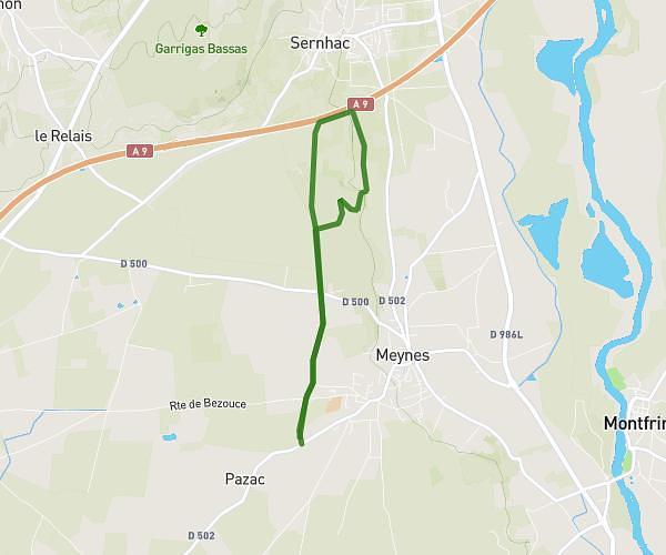
This walking route covers 1.777mi starting from Meynes, Gard. The walk is a loop trail and returns to the trailhead. This walk is rated as easy, plan for about 38m to complete it. The route has an elevation gain of 39ft and an elevation loss of 39ft.
equipe 1
Route details
21:25/mi
Pace
155 kcal
Calories burned
Loop trail
Route type
230ft
Min altitude
243ft
Max altitude
Route profile
39ft
Elevation gain
39ft
Elevation loss
230ft
Min altitude
243ft
Max altitude
How to get there
Trailhead: Chemin De La Croix De Pitot, 30840 Meynes, France
GPS coordinates of the trailhead: 43.87467, 4.548901 / 43°52'28'' N, 4°32'56'' E