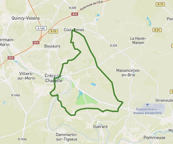
This hiking trail covers 10.233mi starting from Coulommes, Seine-et-Marne. The hike does not return to the trailhead and ends near 13 Place Du Marché, 77580 Crécy-la-Chapelle, France. This hike is rated as moderate, plan for about 4h7m to complete it. The route has an elevation gain of 584ft and an elevation loss of 915ft.
24/02
Route details
2.49mph
Speed
1760 kcal
Calories burned
2.8%
Avg grade
Point to point
Route type
164ft
Min altitude
509ft
Max altitude
Route profile
584ft
Elevation gain
915ft
Elevation loss
164ft
Min altitude
509ft
Max altitude
How to get there
Trailhead: 16 Rue De Courcelles, 77580 Coulommes, France
GPS coordinates of the trailhead: 48.892238, 2.930672 / 48°53'32'' N, 2°55'50'' E