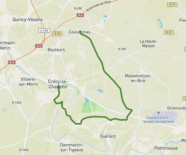
This hiking trail covers 14.101mi starting from Coulommes, Seine-et-Marne. The hike is a loop trail and returns to the trailhead. This hike is rated as hard, plan for about 5h40m to complete it. The route has an elevation gain of 1014ft and an elevation loss of 1014ft.
24/02 pt2
Route details
2.49mph
Speed
2437 kcal
Calories burned
2.7%
Avg grade
Loop trail
Route type
164ft
Min altitude
502ft
Max altitude
Route profile
1014ft
Elevation gain
1014ft
Elevation loss
164ft
Min altitude
502ft
Max altitude
How to get there
Trailhead: 16 Rue De Courcelles, 77580 Coulommes, France
GPS coordinates of the trailhead: 48.892238, 2.930672 / 48°53'32'' N, 2°55'50'' E