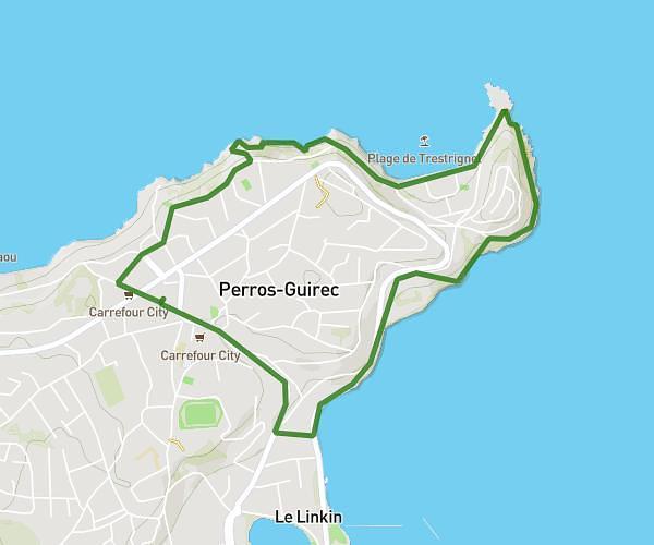
This hiking trail covers 2.492mi starting from Perros-Guirec, Côtes-d'Armor. The hike is a loop trail and returns to the trailhead. This hike is rated as easy, plan for about 53m to complete it. The route has an elevation gain of 285ft and an elevation loss of 282ft.
PERROS GUIREC
Route details
2.82mph
Speed
384 kcal
Calories burned
4.3%
Avg grade
Loop trail
Route type
-3ft
Min altitude
184ft
Max altitude
Route profile
285ft
Elevation gain
282ft
Elevation loss
-3ft
Min altitude
184ft
Max altitude
How to get there
Trailhead: 46 Rue De Trestrignel, 22700 Perros-Guirec, France
GPS coordinates of the trailhead: 48.815071, -3.433345 / 48°48'54'' N, 3°26'0'' W