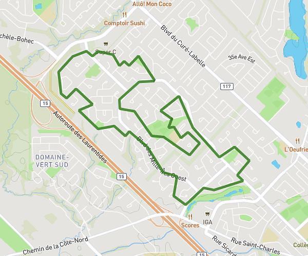
This running route covers 3.155mi starting from Mirabel, Quebec. The run is a loop trail and returns to the trailhead. This run is rated as easy, expect about 30m to complete it. The route has an elevation gain of 10ft and an elevation loss of 20ft.
5km Mirabel
Route details
6.31mph
Speed
343 kcal
Calories burned
Loop trail
Route type
243ft
Min altitude
262ft
Max altitude
Route profile
10ft
Elevation gain
20ft
Elevation loss
243ft
Min altitude
262ft
Max altitude
How to get there
Trailhead: Rue De L'eau-Vive, J7J 2L2 Mirabel
GPS coordinates of the trailhead: 45.75754, -73.96701 / 45°45'27'' N, 73°58'1'' W