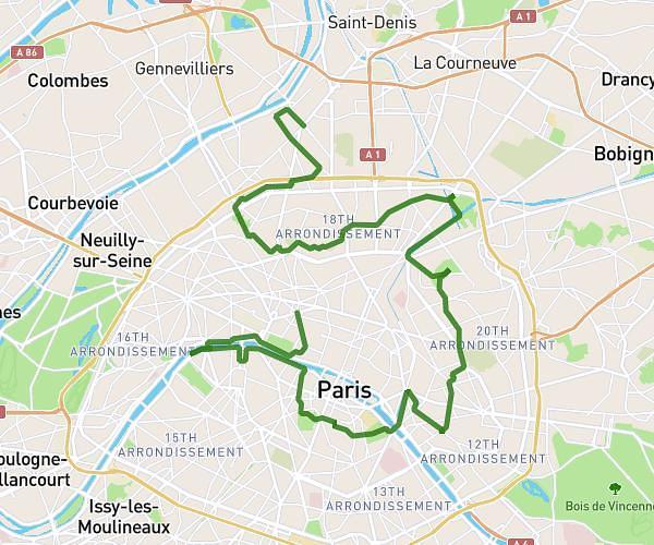
This hiking trail covers 5.691mi starting from Île-de-France, Paris. The hike does not return to the trailhead and ends near 134 Rue Saint-Honoré, 75001 Paris, France. This hike is rated as moderate, plan for about 1h56m to complete it. The route has an elevation gain of 466ft and an elevation loss of 479ft.
Itinéraire visite 2
Route details
2.93mph
Speed
838 kcal
Calories burned
3.1%
Avg grade
Point to point
Route type
95ft
Min altitude
213ft
Max altitude
Route profile
466ft
Elevation gain
479ft
Elevation loss
95ft
Min altitude
213ft
Max altitude
How to get there
Trailhead: 7 Rue Lacretelle, 75015 Paris, France
GPS coordinates of the trailhead: 48.833718, 2.29118 / 48°50'1'' N, 2°17'28'' E