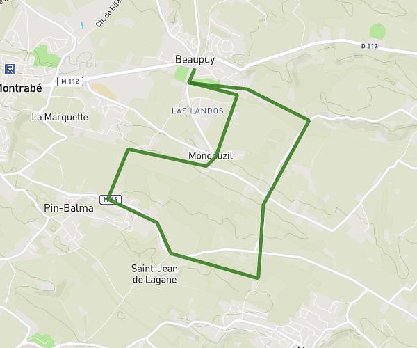
This running route covers 6.84mi starting from Saint-Orens-de-Gameville, Haute-Garonne. The run is a loop trail and returns to the trailhead. This run is rated as moderate, expect about 1h48m to complete it. The route has an elevation gain of 13ft and an elevation loss of 3ft.
Lolo
Route details
3.79mph
Speed
1238 kcal
Calories burned
Loop trail
Route type
499ft
Min altitude
509ft
Max altitude
Route profile
13ft
Elevation gain
3ft
Elevation loss
499ft
Min altitude
509ft
Max altitude
How to get there
Trailhead: 11 Rue Des Mousserons, 31650 Saint-Orens-de-Gameville, France
GPS coordinates of the trailhead: 43.55456, 1.51801 / 43°33'16'' N, 1°31'4'' E