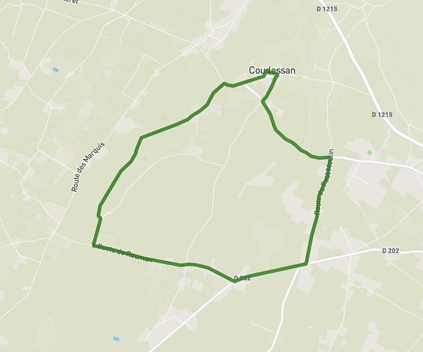
This running route covers 12.688mi starting from Hourtin, Gironde. The run is a loop trail and returns to the trailhead. This run is rated as strenuous, expect about 2h16m to complete it. The route has an elevation gain of 3ft and an elevation loss of 0ft.
20km hourtin
Route details
5.6mph
Speed
1555 kcal
Calories burned
Loop trail
Route type
52ft
Min altitude
56ft
Max altitude
Route profile
3ft
Elevation gain
0ft
Elevation loss
52ft
Min altitude
56ft
Max altitude
How to get there
Trailhead: 1 Impasse Du Petit Pont, 33990 Hourtin, France
GPS coordinates of the trailhead: 45.184902, -1.083975 / 45°11'5'' N, 1°5'2'' W