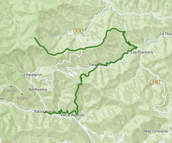
This hiking trail covers 8.819mi starting from Val-d'Aigoual, Gard. The hike does not return to the trailhead and ends near 48400, Bassurels, Lozère, France. This hike is rated as strenuous, plan for about 5h35m to complete it. The route has an elevation gain of 4800ft and an elevation loss of 2398ft.
Valleraugue - Aire de Cote
Route details
1.58mph
Speed
2748 kcal
Calories burned
15.5%
Avg grade
Point to point
Route type
1158ft
Min altitude
5108ft
Max altitude
Steep climb
Route profile
4800ft
Elevation gain
2398ft
Elevation loss
1158ft
Min altitude
5108ft
Max altitude
How to get there
Trailhead: 5 Place Élysée, 30570 Val-d'Aigoual, France
GPS coordinates of the trailhead: 44.080453, 3.641568 / 44°4'49'' N, 3°38'29'' E