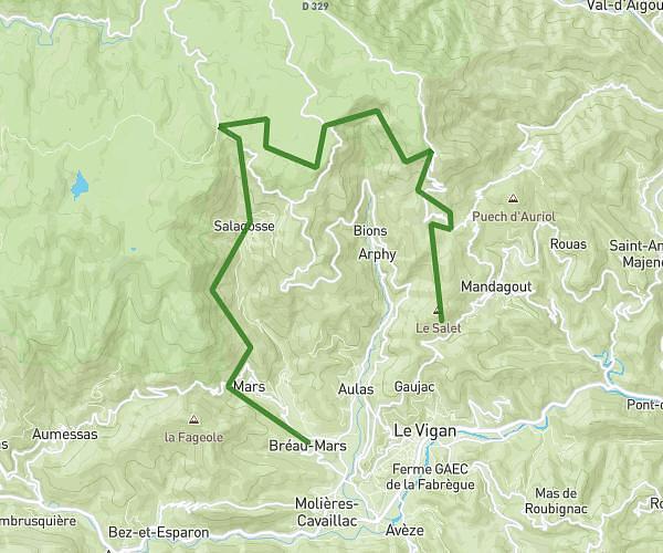
This hiking trail covers 4.97mi starting from Bez-et-Esparon, Gard. The hike does not return to the trailhead and ends near 2 Place De La Prisonnière, 30120 Bréau-Mars, France. This hike is rated as hard, plan for about 1h17m to complete it. The route has an elevation gain of 1391ft and an elevation loss of 1719ft.
cévennes 3
Route details
3.87mph
Speed
587 kcal
Calories burned
11.9%
Avg grade
Point to point
Route type
1332ft
Min altitude
2014ft
Max altitude
Steep climb
Route profile
1391ft
Elevation gain
1719ft
Elevation loss
1332ft
Min altitude
2014ft
Max altitude
How to get there
Trailhead: 1 Chemin Du Bosc, 30120 Bez-et-Esparon, France
GPS coordinates of the trailhead: 43.984502, 3.527209 / 43°59'4'' N, 3°31'37'' E