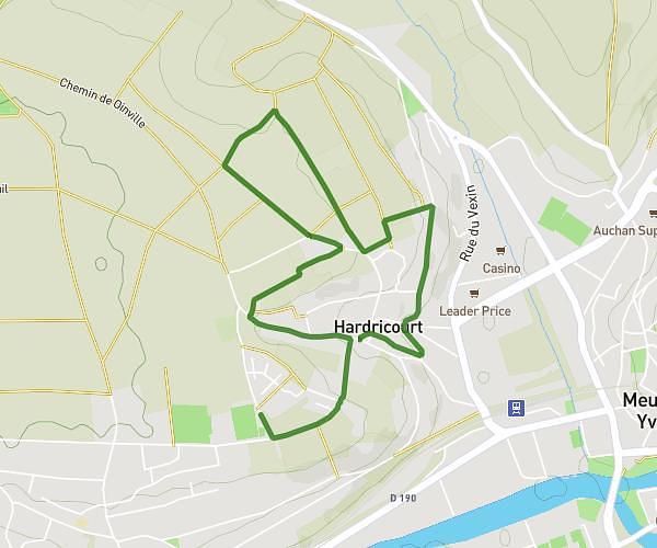
This hiking trail covers 3.675mi starting from Montreuil-sur-Epte, Val-d'Oise. The hike is a loop trail and returns to the trailhead. This hike is rated as easy, plan for about 1h16m to complete it. The route has an elevation gain of 308ft and an elevation loss of 308ft.
balade co
Route details
2.9mph
Speed
546 kcal
Calories burned
3.2%
Avg grade
Loop trail
Route type
256ft
Min altitude
440ft
Max altitude
Route profile
308ft
Elevation gain
308ft
Elevation loss
256ft
Min altitude
440ft
Max altitude
How to get there
Trailhead: Rue Des Fontaines, 95770 Montreuil-sur-Epte
GPS coordinates of the trailhead: 49.16701, 1.68909 / 49°10'1'' N, 1°41'20'' E