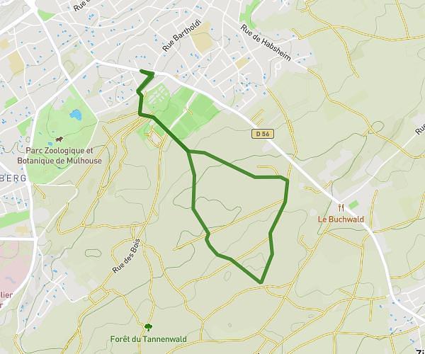
This hiking trail covers 1.942mi starting from Basel, Basel-Stadt. The hike does not return to the trailhead and ends near Reverenzgässlein 2, 4058 Basel, Switzerland. This hike is rated as easy, plan for about 42m to complete it. The route has an elevation gain of 184ft and an elevation loss of 243ft.
Basel
Route details
2.78mph
Speed
303 kcal
Calories burned
4.2%
Avg grade
Point to point
Route type
827ft
Min altitude
912ft
Max altitude
Route profile
184ft
Elevation gain
243ft
Elevation loss
827ft
Min altitude
912ft
Max altitude
How to get there
Trailhead: Petersplatz 14, 4051 Basel, Switzerland
GPS coordinates of the trailhead: 47.55951, 7.58353 / 47°33'34'' N, 7°35'0'' E