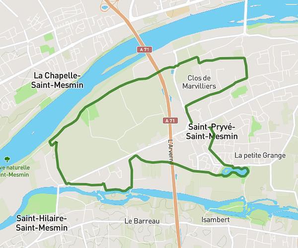
This running route covers 7.757mi starting from Saint-Jean-de-Braye, Loiret. The run is a loop trail and returns to the trailhead. This run is rated as hard, expect about 1h4m to complete it. The route has an elevation gain of 384ft and an elevation loss of 364ft.
Laeti Carinette 19 juil 2025
Route details
7.27mph
Speed
732 kcal
Calories burned
Loop trail
Route type
285ft
Min altitude
338ft
Max altitude
Route profile
384ft
Elevation gain
364ft
Elevation loss
285ft
Min altitude
338ft
Max altitude
How to get there
Trailhead: 17 Rue Du Port Saint-Loup, 45800 Saint-Jean-de-Braye, France
GPS coordinates of the trailhead: 47.90263, 1.94068 / 47°54'9'' N, 1°56'26'' E