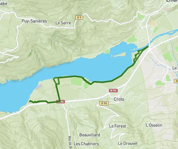
This running route covers 6.485mi starting from L'Argentière-la-Bessée, Hautes-Alpes. The run is a loop trail and returns to the trailhead. This run is rated as moderate, expect about 1h10m to complete it. The route has an elevation gain of 1102ft and an elevation loss of 1099ft.
ABC-UBAC-Rama
Route details
5.56mph
Speed
800 kcal
Calories burned
Loop trail
Route type
3120ft
Min altitude
3845ft
Max altitude
Route profile
1102ft
Elevation gain
1099ft
Elevation loss
3120ft
Min altitude
3845ft
Max altitude
How to get there
Trailhead: 3 Rue Du Quartz, 05120 L'Argentière-la-Bessée, France
GPS coordinates of the trailhead: 44.78236, 6.5567 / 44°46'56'' N, 6°33'24'' E