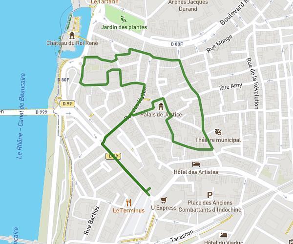
This hiking trail covers 2.787mi starting from Caissargues, Gard. The hike is a loop trail and returns to the trailhead. This hike is rated as easy, plan for about 55m to complete it. The route has an elevation gain of 69ft and an elevation loss of 69ft.
Caissargues 1
Route details
3.04mph
Speed
388 kcal
Calories burned
0.9%
Avg grade
Loop trail
Route type
72ft
Min altitude
102ft
Max altitude
Route profile
69ft
Elevation gain
69ft
Elevation loss
72ft
Min altitude
102ft
Max altitude
How to get there
Trailhead: 4 Rue Chanclair, 30132 Caissargues, France
GPS coordinates of the trailhead: 43.79881, 4.3769 / 43°47'55'' N, 4°22'36'' E