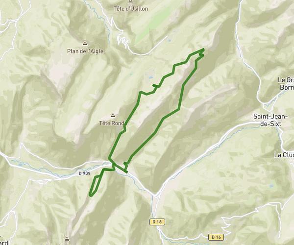
This hiking trail covers 2.988mi starting from Le Grand-Bornand, Haute-Savoie. The hike does not return to the trailhead and ends near 74130, Glières-Val-de-Borne, Haute-Savoie, France. This hike is rated as hard, plan for about 2h17m to complete it. The route has an elevation gain of 2182ft and an elevation loss of 607ft.
Test
Route details
1.31mph
Speed
1180 kcal
Calories burned
17.7%
Avg grade
Point to point
Route type
4226ft
Min altitude
6214ft
Max altitude
Steep climb
Route profile
2182ft
Elevation gain
607ft
Elevation loss
4226ft
Min altitude
6214ft
Max altitude
How to get there
Trailhead: 7007 Route Du Chinaillon, 74450 Le Grand-Bornand, France
GPS coordinates of the trailhead: 45.973954, 6.45507 / 45°58'26'' N, 6°27'18'' E