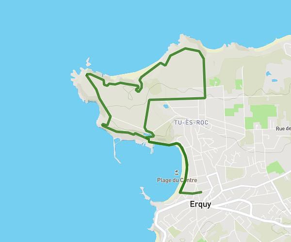
This hiking trail covers 7.082mi starting from Pléneuf-Val-André, Côtes-d'Armor. The hike does not return to the trailhead and ends near Boulevard De La Mer, 22430 Erquy. This hike is rated as moderate, plan for about 3h15m to complete it. The route has an elevation gain of 794ft and an elevation loss of 810ft.
étape 3
Route details
2.17mph
Speed
1416 kcal
Calories burned
4.3%
Avg grade
Point to point
Route type
0ft
Min altitude
190ft
Max altitude
Route profile
794ft
Elevation gain
810ft
Elevation loss
0ft
Min altitude
190ft
Max altitude
How to get there
Trailhead: Rue Des Embruns, 22370 Pléneuf-Val-André
GPS coordinates of the trailhead: 48.58597, -2.55908 / 48°35'9'' N, 2°33'32'' W