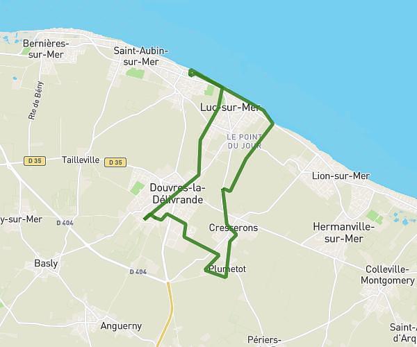
This hiking trail covers 5.225mi starting from Colombiers-sur-Seulles, Calvados. The hike does not return to the trailhead and ends near 1 Rue Du Château D'eau, 14610 Thaon, France. This hike is rated as easy, plan for about 1h53m to complete it. The route has an elevation gain of 381ft and an elevation loss of 272ft.
Eglise thaon
Route details
2.77mph
Speed
809 kcal
Calories burned
2.4%
Avg grade
Point to point
Route type
16ft
Min altitude
161ft
Max altitude
Route profile
381ft
Elevation gain
272ft
Elevation loss
16ft
Min altitude
161ft
Max altitude
How to get there
Trailhead: 1 Ruette Du Cagny, 14480 Colombiers-sur-Seulles, France
GPS coordinates of the trailhead: 49.293727, -0.512148 / 49°17'37'' N, 0°30'43'' W