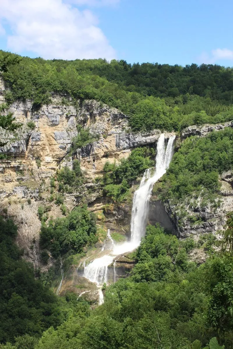
This hiking trail covers 0.854mi starting from Chaley, Ain. The hike does not return to the trailhead and ends near D 21, 01110 Plateau d'Hauteville, France. This hike is rated as easy, plan for about 27m30s to complete it. The route has an elevation gain of 505ft and an elevation loss of 72ft.
Cascade de Charabotte
Route details
1.86mph
Speed
228 kcal
Calories burned
12.8%
Avg grade
Point to point
Route type
1490ft
Min altitude
1923ft
Max altitude
Steep climb
Route profile
505ft
Elevation gain
72ft
Elevation loss
1490ft
Min altitude
1923ft
Max altitude
How to get there
Trailhead: 1 Charabotte Le Moulin, 01230 Chaley, France
GPS coordinates of the trailhead: 45.95849, 5.5543 / 45°57'30'' N, 5°33'15'' E