This hiking trail covers 1.037mi starting from Rogna, Jura. The hike does not return to the trailhead and ends near 1 Chemin De La Cascade, 39360 Vulvoz, France. This hike is rated as easy, plan for about 33m22s to complete it. The route has an elevation gain of 207ft and an elevation loss of 285ft.
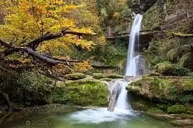
Cascade du Moulin de Vulvoz
Route details
1.86mph
Speed
248 kcal
Calories burned
9.0%
Avg grade
Point to point
Route type
1617ft
Min altitude
1821ft
Max altitude
Steep climb
Route profile
207ft
Elevation gain
285ft
Elevation loss
1617ft
Min altitude
1821ft
Max altitude
How to get there
Trailhead: Le Crêt Des Gorges, 39360 Rogna, France
GPS coordinates of the trailhead: 46.32118, 5.76128 / 46°19'16'' N, 5°45'40'' E


