This hiking trail covers 3.568mi starting from Villard-Saint-Sauveur, Jura. The hike does not return to the trailhead and ends near Route De Chaumont, 39200 Saint-Claude, France. This hike is rated as hard, plan for about 1h54m to complete it. The route has an elevation gain of 1650ft and an elevation loss of 679ft.
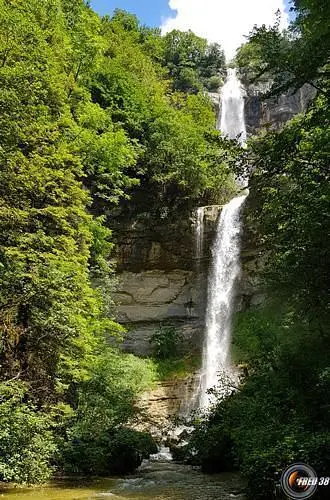
Cascades du Grodard

Route details
1.86mph
Speed
921 kcal
Calories burned
12.4%
Avg grade
Point to point
Route type
1460ft
Min altitude
2507ft
Max altitude
Steep climb
Route profile
1650ft
Elevation gain
679ft
Elevation loss
1460ft
Min altitude
2507ft
Max altitude
How to get there
Trailhead: Route De La Faucille, 39200 Villard-Saint-Sauveur, France
GPS coordinates of the trailhead: 46.37579, 5.87942 / 46°22'32'' N, 5°52'45'' E


