This hiking trail covers 3.246mi starting from Champagne-en-Valromey, Ain. The hike does not return to the trailhead and ends near 94 Rue Des Tines, 01260 Champagne-en-Valromey, France. This hike is rated as moderate, plan for about 1h44m to complete it. The route has an elevation gain of 466ft and an elevation loss of 778ft.
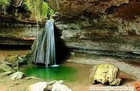
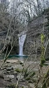
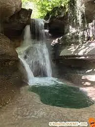
cascades du Valromey
Route details
1.86mph
Speed
764 kcal
Calories burned
7.3%
Avg grade
Point to point
Route type
1788ft
Min altitude
2208ft
Max altitude
Route profile
466ft
Elevation gain
778ft
Elevation loss
1788ft
Min altitude
2208ft
Max altitude
How to get there
Trailhead: Chemin De Bergon, 01260 Champagne-en-Valromey, France
GPS coordinates of the trailhead: 45.93883, 5.71344 / 45°56'19'' N, 5°42'48'' E