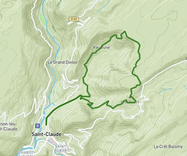
This hiking trail covers 18.535mi starting from Farges, Ain. The hike does not return to the trailhead and ends near 01200 Injoux-Génissiat. This hike is rated as strenuous, plan for about 8h31m to complete it. The route has an elevation gain of 4442ft and an elevation loss of 4537ft.
jour 3
Route details
2.17mph
Speed
3848 kcal
Calories burned
9.2%
Avg grade
Point to point
Route type
1135ft
Min altitude
5279ft
Max altitude
Steep climb
Route profile
4442ft
Elevation gain
4537ft
Elevation loss
1135ft
Min altitude
5279ft
Max altitude
How to get there
Trailhead: 01550 Farges
GPS coordinates of the trailhead: 46.16194, 5.86701 / 46°9'42'' N, 5°52'1'' E