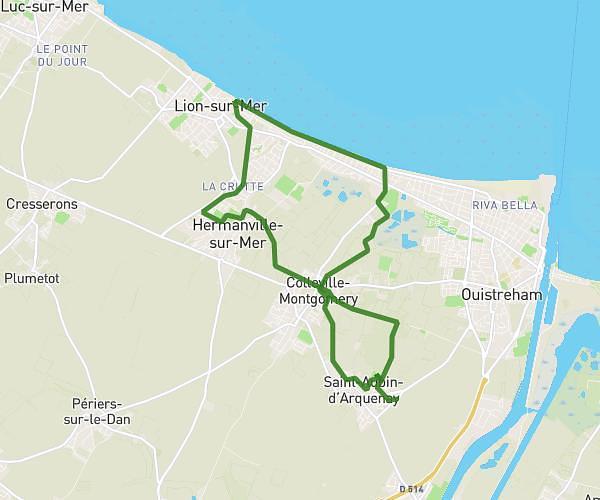
This hiking trail covers 5.075mi starting from Mézidon Vallée d'Auge, Calvados. The hike is a loop trail and returns to the trailhead. This hike is rated as easy, plan for about 1h46m to complete it. The route has an elevation gain of 167ft and an elevation loss of 167ft.
Puma
Route details
2.87mph
Speed
750 kcal
Calories burned
1.2%
Avg grade
Loop trail
Route type
59ft
Min altitude
115ft
Max altitude
Route profile
167ft
Elevation gain
167ft
Elevation loss
59ft
Min altitude
115ft
Max altitude
How to get there
Trailhead: 10 Avenue Du Château De Canon, 14270 Mézidon Vallée d'Auge, France
GPS coordinates of the trailhead: 49.078448, -0.094534 / 49°4'42'' N, 0°5'40'' W