MapPlanner
9.869mi
Distance
1h
Duration
9.87mph
Speed
+115ft
Elevation gain
-98ft
Elevation loss
Easy
Level

Champ de. Mars

Route details

527 kcal
Calories burned
0.4%
Avg grade
Loop trail
Route type
82ft
Min altitude
197ft
Max altitude

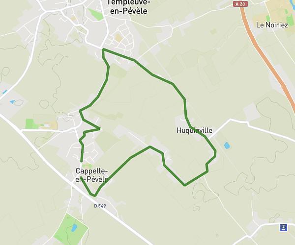
This cycling route covers 9.869mi starting from Faches-Thumesnil, Nord. The ride is a loop trail and returns to the trailhead. This route is rated as easy, plan for about 1h to complete it. The route has an elevation gain of 115ft and an elevation loss of 98ft.

Route profile

115ft
Elevation gain
98ft
Elevation loss
82ft
Min altitude
197ft
Max altitude

How to get there

Trailhead: Rue Luchino Visconti, 59155 Faches-Thumesnil

GPS coordinates of the trailhead: 50.58661, 3.08036 / 50°35'11'' N, 3°4'49'' E

Caution: May Cross Private Property

This route may pass through or near private property. Always respect posted signs, obtain permission where required, and follow local trespassing laws. MapPlanner does not guarantee public access along any route.

Safety Notice

Trail and road conditions may change without notice due to weather, construction, or other factors. Always verify current conditions before heading out. You are responsible for your own safety — follow local signage, obey traffic laws, and use your best judgment on the trail.