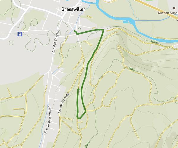
This walking route covers 4.97mi starting from Oberhausbergen, Bas-Rhin. The walk is a loop trail and returns to the trailhead. This walk is rated as moderate, plan for about 1h47m to complete it. The route has an elevation gain of 299ft and an elevation loss of 299ft.
Oberpark + Collines Sud
Route details
21:33/mi
Pace
437 kcal
Calories burned
Loop trail
Route type
472ft
Min altitude
633ft
Max altitude
Route profile
299ft
Elevation gain
299ft
Elevation loss
472ft
Min altitude
633ft
Max altitude
How to get there
Trailhead: 3 Rue Claudie Haigneré, 67205 Oberhausbergen, France
GPS coordinates of the trailhead: 48.605446, 7.700751 / 48°36'19'' N, 7°42'2'' E