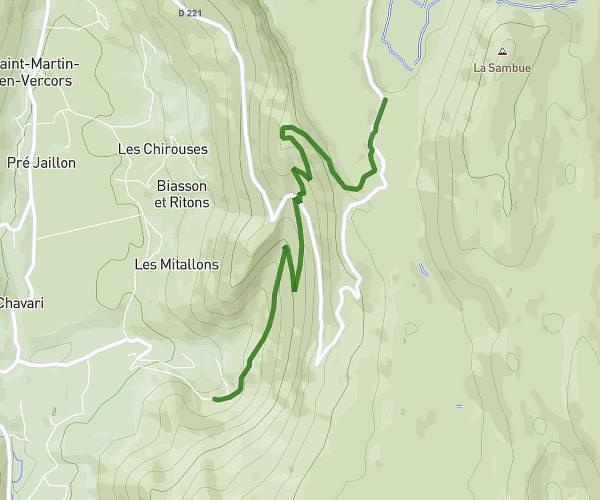
This hiking trail covers 4.444mi starting from Monestier-de-Clermont, Isère. The hike does not return to the trailhead and ends near 38650, Gresse-en-Vercors, Isère, France. This hike is rated as strenuous, plan for about 3h22m to complete it. The route has an elevation gain of 3369ft and an elevation loss of 243ft.
Maison rocher du baconnet
Route details
1.32mph
Speed
1752 kcal
Calories burned
15.4%
Avg grade
Point to point
Route type
2694ft
Min altitude
5843ft
Max altitude
Steep climb
Route profile
3369ft
Elevation gain
243ft
Elevation loss
2694ft
Min altitude
5843ft
Max altitude
How to get there
Trailhead: 4 Rue Traversine, 38650 Monestier-de-Clermont, France
GPS coordinates of the trailhead: 44.917228, 5.635599 / 44°55'2'' N, 5°38'8'' E