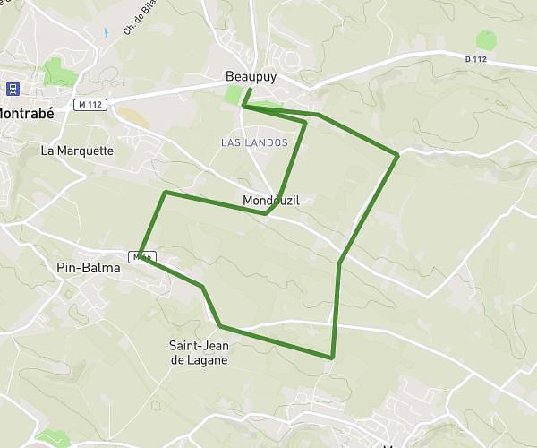
This running route covers 8.199mi starting from Balma, Haute-Garonne. The run is a loop trail and returns to the trailhead. This run is rated as moderate, expect about 1h21m to complete it. The route has an elevation gain of 682ft and an elevation loss of 682ft.
13 KM BALMA
Route details
6.07mph
Speed
926 kcal
Calories burned
Loop trail
Route type
479ft
Min altitude
738ft
Max altitude
Route profile
682ft
Elevation gain
682ft
Elevation loss
479ft
Min altitude
738ft
Max altitude
How to get there
Trailhead: 5 Le Clos Des Arnis, 31130 Balma, France
GPS coordinates of the trailhead: 43.59365, 1.50718 / 43°35'37'' N, 1°30'25'' E