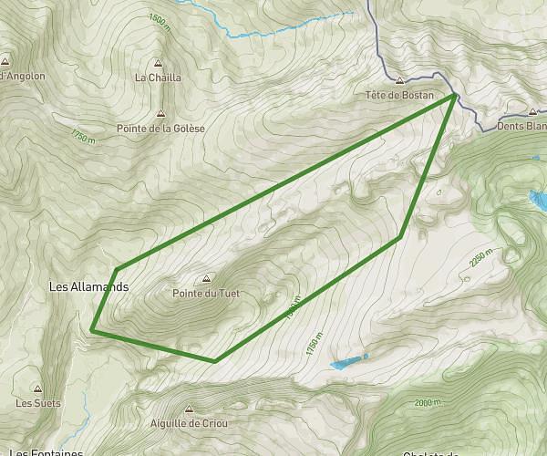
This hiking trail covers 8.933mi starting from Habère-Poche, Haute-Savoie. The hike is a loop trail and returns to the trailhead. This hike is rated as moderate, plan for about 3h35m to complete it. The route has an elevation gain of 1932ft and an elevation loss of 1929ft.
autour du forçat
Route details
2.49mph
Speed
1613 kcal
Calories burned
8.2%
Avg grade
Loop trail
Route type
3284ft
Min altitude
3986ft
Max altitude
Steep climb
Route profile
1932ft
Elevation gain
1929ft
Elevation loss
3284ft
Min altitude
3986ft
Max altitude
How to get there
Trailhead: 295 Route Des Grands Champs, 74420 Habère-Poche, France
GPS coordinates of the trailhead: 46.25627, 6.47522 / 46°15'22'' N, 6°28'30'' E