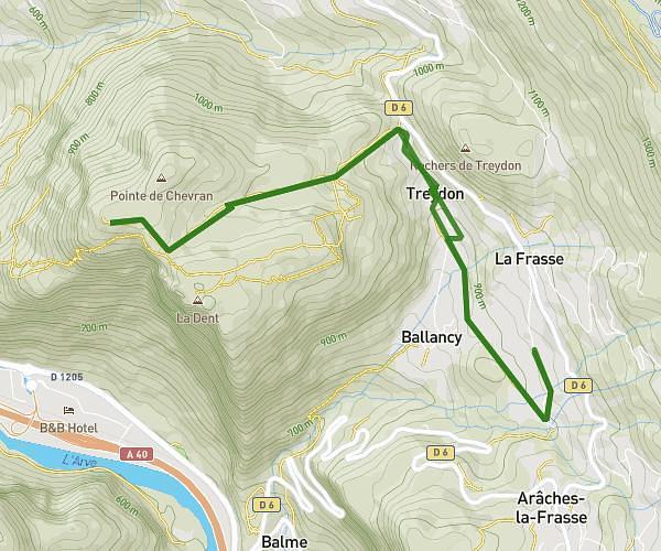
This hiking trail covers 6.224mi starting from Morzine, Haute-Savoie. The hike does not return to the trailhead and ends near 2786 Route Des Ardoisières, 74110 Morzine, France. This hike is rated as strenuous, plan for about 3h30m to complete it. The route has an elevation gain of 1693ft and an elevation loss of 3786ft.
Morzinette
Route details
1.78mph
Speed
1596 kcal
Calories burned
16.7%
Avg grade
Point to point
Route type
3835ft
Min altitude
6686ft
Max altitude
Steep climb
Route profile
1693ft
Elevation gain
3786ft
Elevation loss
3835ft
Min altitude
6686ft
Max altitude
How to get there
Trailhead: 10 Route Des Rennes, 74110 Morzine, France
GPS coordinates of the trailhead: 46.19045, 6.77666 / 46°11'25'' N, 6°46'35'' E