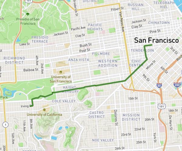
This walking route covers 6.339mi starting from San Francisco, California. The walk does not return to the trailhead and ends near 651 Mason Street, San Francisco, California 94129, United States. This walk is rated as hard, plan for about 2h35m to complete it. The route has an elevation gain of 581ft and an elevation loss of 656ft.
SF día 2
Route details
24:27/mi
Pace
633 kcal
Calories burned
Point to point
Route type
0ft
Min altitude
240ft
Max altitude
Route profile
581ft
Elevation gain
656ft
Elevation loss
0ft
Min altitude
240ft
Max altitude
How to get there
Trailhead: 167 Powell Street, San Francisco, California 94102, United States
GPS coordinates of the trailhead: 37.786216, -122.408072 / 37°47'10'' N, 122°24'29'' W