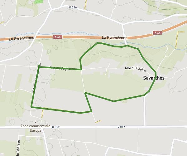
This running route covers 4.311mi starting from Pointis-de-Rivière, Haute-Garonne. The run is a loop trail and returns to the trailhead. This run is rated as easy, expect about 46m to complete it. The route has an elevation gain of 161ft and an elevation loss of 157ft.
Pointis de rivière 1
Route details
5.62mph
Speed
526 kcal
Calories burned
Loop trail
Route type
1296ft
Min altitude
1371ft
Max altitude
Route profile
161ft
Elevation gain
157ft
Elevation loss
1296ft
Min altitude
1371ft
Max altitude
How to get there
Trailhead: 4 Lotissement Du Cagire, 31210 Pointis-de-Rivière, France
GPS coordinates of the trailhead: 43.085739, 0.629062 / 43°5'8'' N, 0°37'44'' E