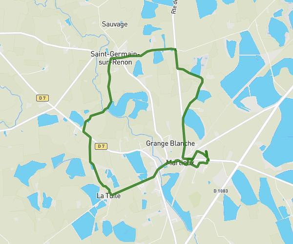
This hiking trail covers 5.996mi starting from La Boisse, Ain. The hike is a loop trail and returns to the trailhead. This hike is rated as moderate, plan for about 1h55m to complete it. The route has an elevation gain of 768ft and an elevation loss of 768ft.
Beynost
Route details
3.11mph
Speed
843 kcal
Calories burned
4.8%
Avg grade
Loop trail
Route type
715ft
Min altitude
1024ft
Max altitude
Route profile
768ft
Elevation gain
768ft
Elevation loss
715ft
Min altitude
1024ft
Max altitude
How to get there
Trailhead: A 432, 01700 Beynost, France
GPS coordinates of the trailhead: 45.84404, 5.01776 / 45°50'38'' N, 5°1'3'' E