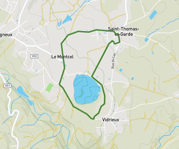
This walking route covers 4.23mi starting from Saint-Thomas-la-Garde, Loire. The walk is a loop trail and returns to the trailhead. This walk is rated as moderate, plan for about 1h31m to complete it. The route has an elevation gain of 469ft and an elevation loss of 469ft.
Lezigneux
Route details
21:30/mi
Pace
372 kcal
Calories burned
Loop trail
Route type
1463ft
Min altitude
1808ft
Max altitude
Route profile
469ft
Elevation gain
469ft
Elevation loss
1463ft
Min altitude
1808ft
Max altitude
How to get there
Trailhead: 25 Rue Du Lac, 42600 Saint-Thomas-la-Garde, France
GPS coordinates of the trailhead: 45.567019, 4.080659 / 45°34'1'' N, 4°4'50'' E