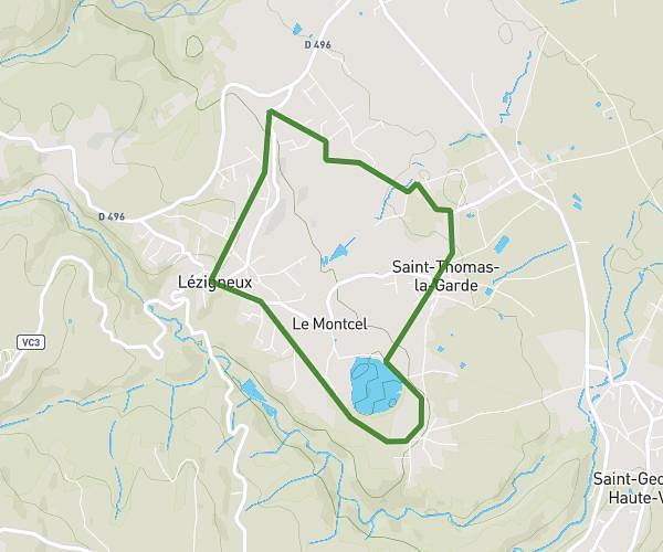
This walking route covers 2.197mi starting from Saint-Thomas-la-Garde, Loire. The walk is a loop trail and returns to the trailhead. This walk is rated as easy, plan for about 59m to complete it. The route has an elevation gain of 276ft and an elevation loss of 279ft.
Tour d'étang
Route details
26:54/mi
Pace
241 kcal
Calories burned
Loop trail
Route type
1519ft
Min altitude
1699ft
Max altitude
Route profile
276ft
Elevation gain
279ft
Elevation loss
1519ft
Min altitude
1699ft
Max altitude
How to get there
Trailhead: 95 Rue Du Lac, 42600 Saint-Thomas-la-Garde, France
GPS coordinates of the trailhead: 45.566129, 4.080877 / 45°33'58'' N, 4°4'51'' E