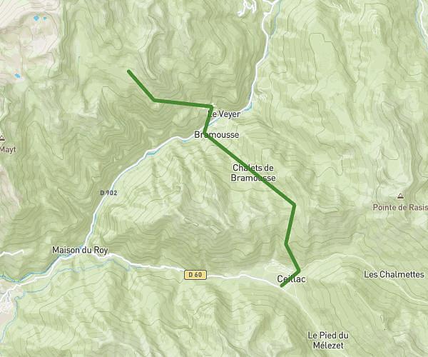
This hiking trail covers 6.583mi starting from Vallouise-Pelvoux, Hautes-Alpes. The hike does not return to the trailhead and ends near 232 Route Du Pra Des Naïs, 05340 Vallouise-Pelvoux, France. This hike is rated as moderate, plan for about 3h31m to complete it. The route has an elevation gain of 338ft and an elevation loss of 1545ft.
ailefroide - vallouise par le gyr ( version pont fermé)
Route details
1.86mph
Speed
1507 kcal
Calories burned
5.4%
Avg grade
Point to point
Route type
3773ft
Min altitude
5003ft
Max altitude
Route profile
338ft
Elevation gain
1545ft
Elevation loss
3773ft
Min altitude
5003ft
Max altitude
How to get there
Trailhead: 3765 Route D'ailefroide, 05340 Vallouise-Pelvoux, France
GPS coordinates of the trailhead: 44.88223, 6.44347 / 44°52'56'' N, 6°26'36'' E