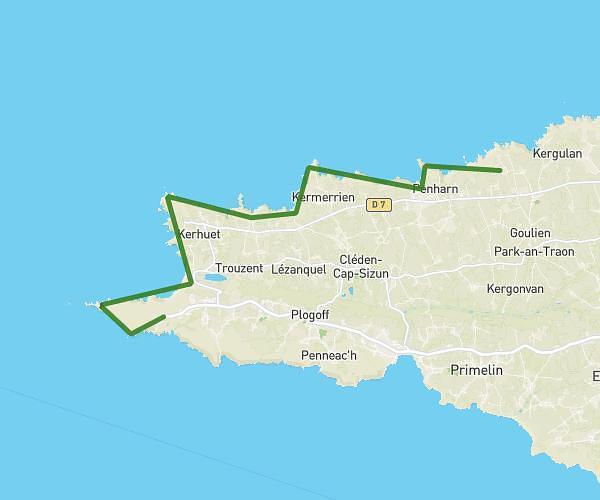
This hiking trail covers 15.913mi starting from Cléden-Cap-Sizun, Finistère. The hike is a loop trail and returns to the trailhead. This hike is rated as strenuous, plan for about 8h42m to complete it. The route has an elevation gain of 2136ft and an elevation loss of 2136ft.
Cléden Cap Sizun départ pointe du van
Route details
1.83mph
Speed
3809 kcal
Calories burned
5.1%
Avg grade
Loop trail
Route type
16ft
Min altitude
249ft
Max altitude
Route profile
2136ft
Elevation gain
2136ft
Elevation loss
16ft
Min altitude
249ft
Max altitude
How to get there
Trailhead: 116 D 7, 29770 Cléden-Cap-Sizun, France
GPS coordinates of the trailhead: 48.05965, -4.70816 / 48°3'34'' N, 4°42'29'' W