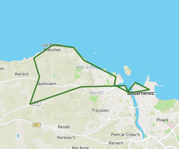
This hiking trail covers 10.865mi starting from Plomeur, Finistère. The hike is a loop trail and returns to the trailhead. This hike is rated as easy, plan for about 6h1m to complete it. The route has an elevation gain of 289ft and an elevation loss of 289ft.
la torche à saint guenole
Route details
1.8mph
Speed
2551 kcal
Calories burned
1.0%
Avg grade
Loop trail
Route type
0ft
Min altitude
52ft
Max altitude
Route profile
289ft
Elevation gain
289ft
Elevation loss
0ft
Min altitude
52ft
Max altitude
How to get there
Trailhead: 75 Kerfeunteun An Dorchenn, 29120 Plomeur, France
GPS coordinates of the trailhead: 47.83684, -4.34616 / 47°50'12'' N, 4°20'46'' W