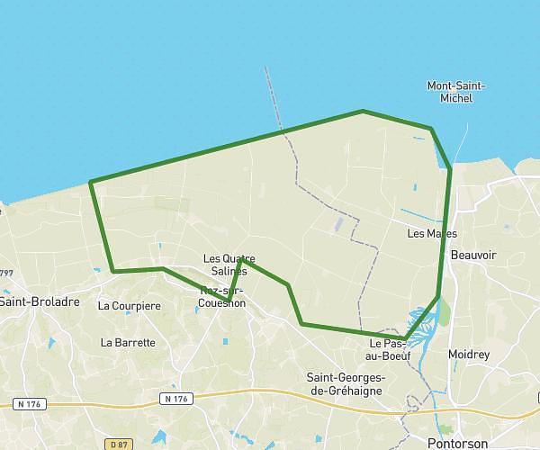
This hiking trail covers 3.815mi starting from Mont-Dol, Ille-et-Vilaine. The hike is a loop trail and returns to the trailhead. This hike is rated as easy, plan for about 2h13m to complete it. The route has an elevation gain of 328ft and an elevation loss of 328ft.
mont dol
Route details
1.71mph
Speed
963 kcal
Calories burned
3.3%
Avg grade
Loop trail
Route type
10ft
Min altitude
207ft
Max altitude
Route profile
328ft
Elevation gain
328ft
Elevation loss
10ft
Min altitude
207ft
Max altitude
How to get there
Trailhead: 4 Rue De L'église Saint-Pierre, 35120 Mont-Dol, France
GPS coordinates of the trailhead: 48.56943, -1.76494 / 48°34'9'' N, 1°45'53'' W