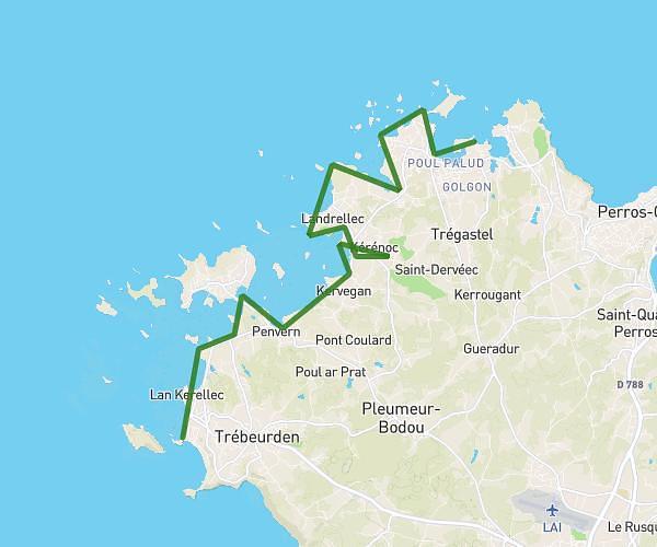
This hiking trail covers 10.947mi starting from Plougasnou, Finistère. The hike does not return to the trailhead and ends near 20 Route De Térénez, 29630 Plougasnou, France. This hike is rated as moderate, plan for about 5h56m to complete it. The route has an elevation gain of 961ft and an elevation loss of 974ft.
TERENEZ
Route details
1.84mph
Speed
2566 kcal
Calories burned
3.3%
Avg grade
Point to point
Route type
3ft
Min altitude
210ft
Max altitude
Route profile
961ft
Elevation gain
974ft
Elevation loss
3ft
Min altitude
210ft
Max altitude
How to get there
Trailhead: 3 Impasse De Pen An Dour, 29630 Plougasnou, France
GPS coordinates of the trailhead: 48.68053, -3.84905 / 48°40'49'' N, 3°50'56'' W