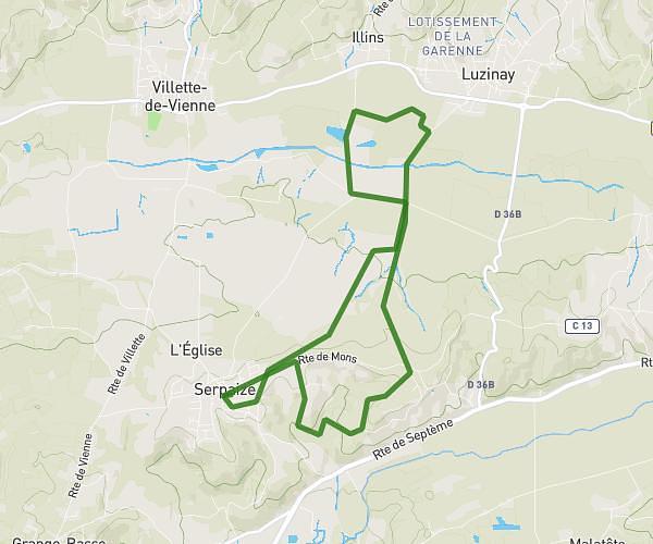
This running route covers 10.939mi starting from Le Péage-de-Roussillon, Isère. The run is a loop trail and returns to the trailhead. This run is rated as hard, expect about 1h28m to complete it. The route has an elevation gain of 236ft and an elevation loss of 236ft.
Oihid 17/12/23
Route details
7.46mph
Speed
1006 kcal
Calories burned
Loop trail
Route type
492ft
Min altitude
531ft
Max altitude
Route profile
236ft
Elevation gain
236ft
Elevation loss
492ft
Min altitude
531ft
Max altitude
How to get there
Trailhead: Rue De La Croix Morand, 38550 Le Péage-de-Roussillon
GPS coordinates of the trailhead: 45.36913, 4.79227 / 45°22'8'' N, 4°47'32'' E