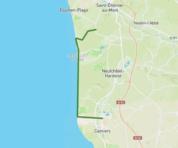
This hiking trail covers 6.199mi starting from Neufchâtel-Hardelot, Pas-de-Calais. The hike is a loop trail and returns to the trailhead. This hike is rated as moderate, plan for about 2h5m to complete it. The route has an elevation gain of 367ft and an elevation loss of 367ft.
HARDELOT 1
Route details
2.98mph
Speed
891 kcal
Calories burned
2.2%
Avg grade
Loop trail
Route type
10ft
Min altitude
253ft
Max altitude
Route profile
367ft
Elevation gain
367ft
Elevation loss
10ft
Min altitude
253ft
Max altitude
How to get there
Trailhead: 15b Avenue De La Concorde, 62152 Neufchâtel-Hardelot, France
GPS coordinates of the trailhead: 50.63207, 1.57922 / 50°37'55'' N, 1°34'45'' E