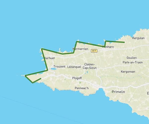
This hiking trail covers 14.769mi starting from Plonévez-Porzay, Finistère. The hike is a loop trail and returns to the trailhead. This hike is rated as hard, plan for about 7h to complete it. The route has an elevation gain of 866ft and an elevation loss of 863ft.
Douarnenez
Route details
2.11mph
Speed
2994 kcal
Calories burned
2.2%
Avg grade
Loop trail
Route type
7ft
Min altitude
180ft
Max altitude
Route profile
866ft
Elevation gain
863ft
Elevation loss
7ft
Min altitude
180ft
Max altitude
How to get there
Trailhead: 38 Ty Anquer, 29550 Plonévez-Porzay, France
GPS coordinates of the trailhead: 48.14726, -4.27199 / 48°8'50'' N, 4°16'19'' W