MapPlanner
5.911mi
Distance
53m20s
Duration
9:01/mi
Pace
Moderate
Level

Remise en Forme

Route details

6.65mph
Speed
610 kcal
Calories burned
Loop trail
Route type
1158ft
Min altitude
1404ft
Max altitude

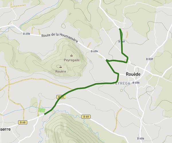
This running route covers 5.911mi starting from Rouède, Haute-Garonne. The run is a loop trail and returns to the trailhead. This run is rated as moderate, expect about 53m20s to complete it. The route has an elevation gain of 187ft and an elevation loss of 249ft.

Description of the route by the creator

Rouède-St Martin-Sarous-Rouède 9.5km

(Description automatically translated)

Route profile

187ft
Elevation gain
249ft
Elevation loss
1158ft
Min altitude
1404ft
Max altitude

How to get there

Trailhead: 390 Route De La Rouquet, 31160 Rouède, France

GPS coordinates of the trailhead: 43.05963, 0.87963 / 43°3'34'' N, 0°52'46'' E

Caution: May Cross Private Property

This route may pass through or near private property. Always respect posted signs, obtain permission where required, and follow local trespassing laws. MapPlanner does not guarantee public access along any route.

Safety Notice

Trail and road conditions may change without notice due to weather, construction, or other factors. Always verify current conditions before heading out. You are responsible for your own safety — follow local signage, obey traffic laws, and use your best judgment on the trail.