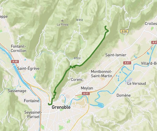
This hiking trail covers 5.974mi starting from Grenoble, Isère. The hike does not return to the trailhead and ends near Route Du Saint-Eynard, 38700 Le Sappey-en-Chartreuse, France. This hike is rated as easy, plan for about 4h41m to complete it. The route has an elevation gain of 4616ft and an elevation loss of 1043ft.
Grenoble Bastille - Fort Saint Eynard
Route details
1.27mph
Speed
2447 kcal
Calories burned
17.9%
Avg grade
Point to point
Route type
748ft
Min altitude
4400ft
Max altitude
Steep climb
Route profile
4616ft
Elevation gain
1043ft
Elevation loss
748ft
Min altitude
4400ft
Max altitude
How to get there
Trailhead: 4 Place Saint-Laurent, 38000 Grenoble, France
GPS coordinates of the trailhead: 45.197871, 5.731165 / 45°11'52'' N, 5°43'52'' E