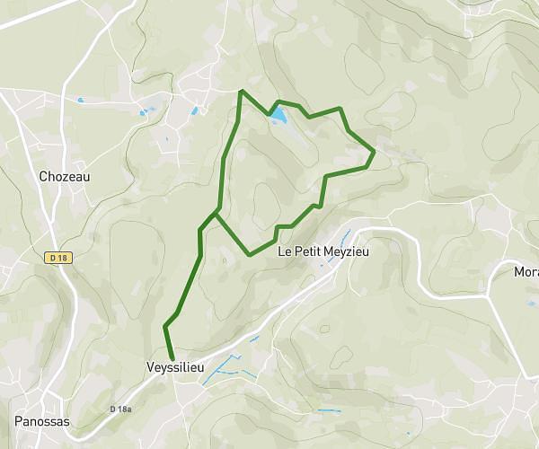
This hiking trail covers 4.179mi starting from Succieu, Isère. The hike is a loop trail and returns to the trailhead. This hike is rated as easy, plan for about 40m to complete it. The route has an elevation gain of 449ft and an elevation loss of 449ft.
ASN 2025 6km
Route details
6.27mph
Speed
290 kcal
Calories burned
4.1%
Avg grade
Loop trail
Route type
1562ft
Min altitude
1913ft
Max altitude
Route profile
449ft
Elevation gain
449ft
Elevation loss
1562ft
Min altitude
1913ft
Max altitude
How to get there
Trailhead: 140 Route Du Stade, 38300 Succieu, France
GPS coordinates of the trailhead: 45.52447, 5.35327 / 45°31'28'' N, 5°21'11'' E