This hiking trail covers 4.726mi starting from Chapeiry, Haute-Savoie. The hike is a loop trail and returns to the trailhead. This hike is rated as easy, plan for about 3h30m to complete it. The route has an elevation gain of 1385ft and an elevation loss of 1388ft.
Description of the route by the creator
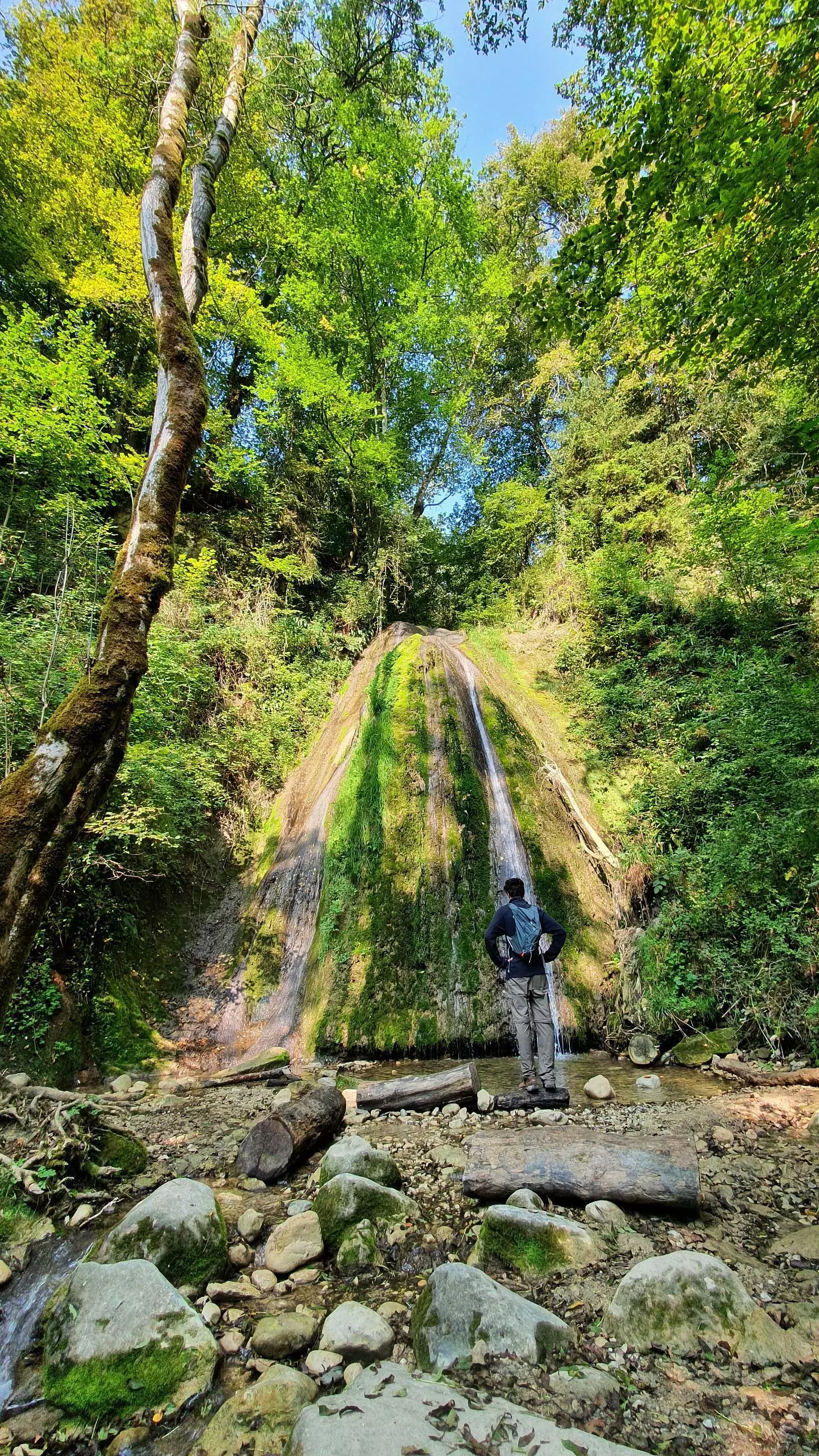
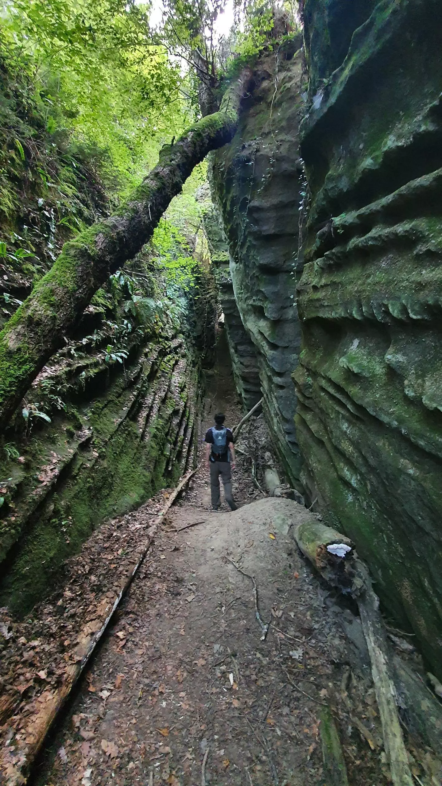
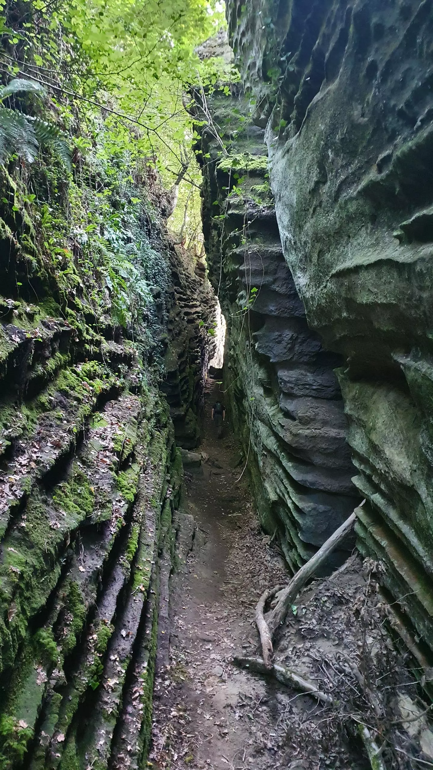
From the parking of Chapeiry, join the "chemin des vignes" which goes down to the waterfall. Then continue the path to the road and take the path across the field to reach the church of Saint-Sylvestre. Once on the square next to the church, take a small path next to the signpost that goes down to the faults of Saint-Sylvestre. Be careful once you reach the faults because of their depth and possible rock falls. Take the path back to the village and then go down the road to the first barn on the left. The way down to Champollier starts after the farmyard. In Champollier, continue downhill until you cross a small river and then turn left to go up to the road that joins Chapeiry.