MapPlanner
10.561mi
Distance
6h3m
Duration
+3927ft
Elevation gain
-3911ft
Elevation loss
Hard
Level

Lac Lessy et Aiguille verte

The Aravis mountain range
Lac de Lessy from the Col de la Forclaz
Lac de Lessy from the summit of Aiguille verte
On the shores of Lac de Lessy
Lake Lessy
Lake Lessy
View from Col de Sosay
View north from Col de Sosay
The Solaison plateau from the Col de Sosay

Route details

1.75mph
Speed
2841 kcal
Calories burned
14.1%
Avg grade
Point to point
Route type
4429ft
Min altitude
6696ft
Max altitude
Steep climb

This hiking trail covers 10.561mi starting from Glières-Val-de-Borne, Haute-Savoie. The hike does not return to the trailhead and ends near . This hike is rated as hard, plan for about 6h3m to complete it. The route has an elevation gain of 3927ft and an elevation loss of 3911ft.

Description of the route by the creator

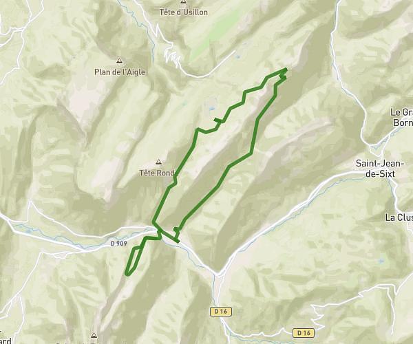
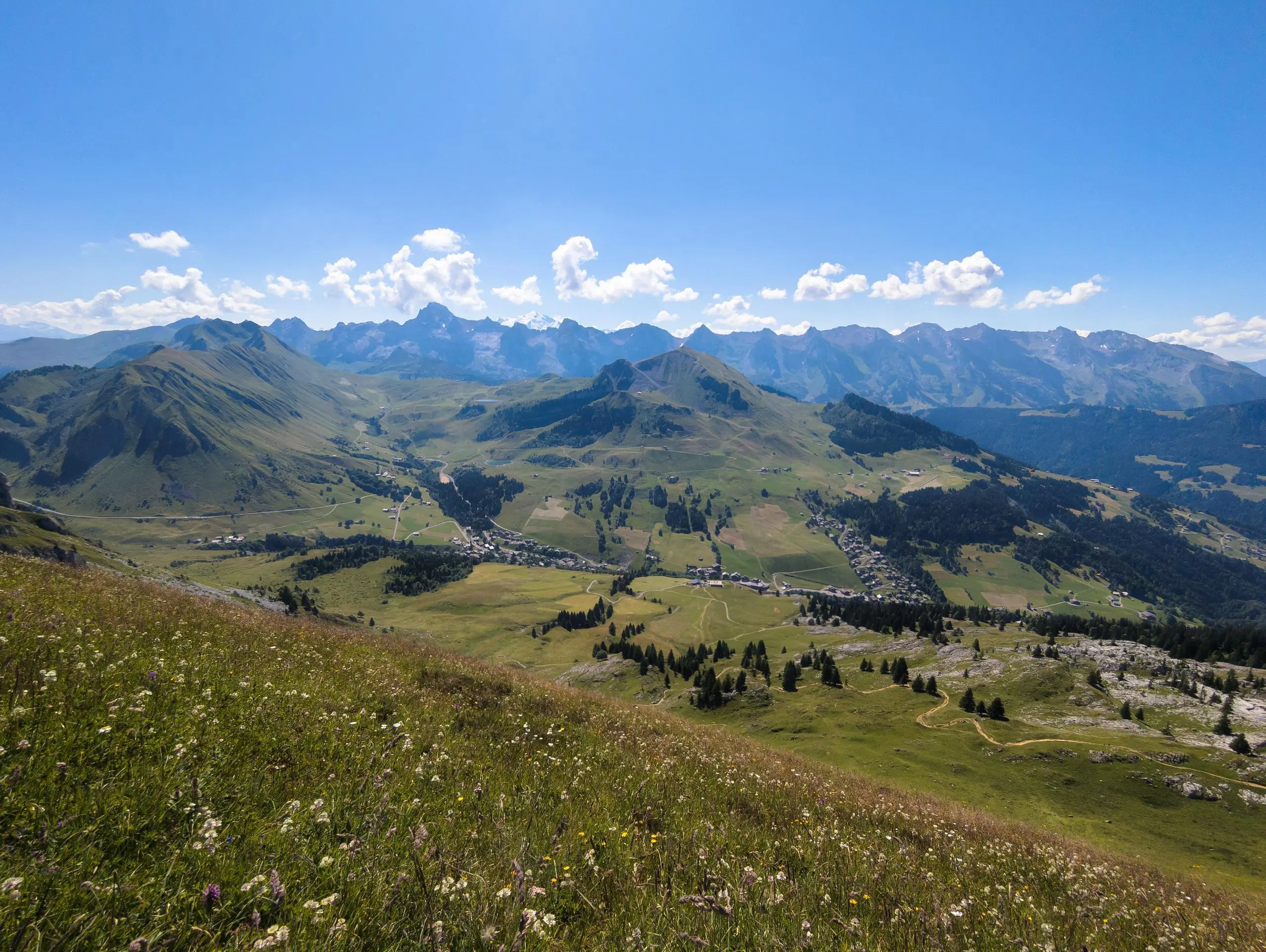
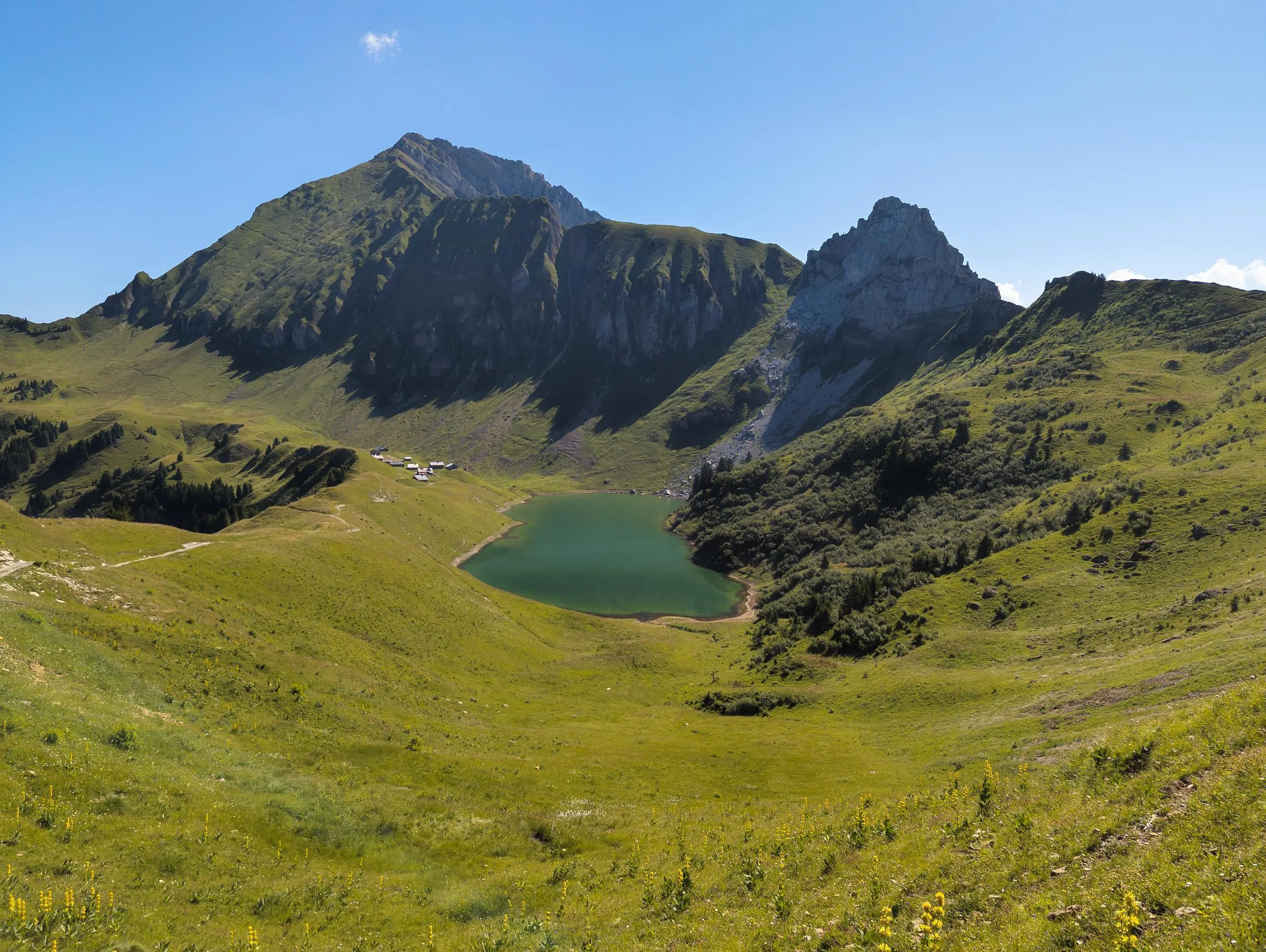
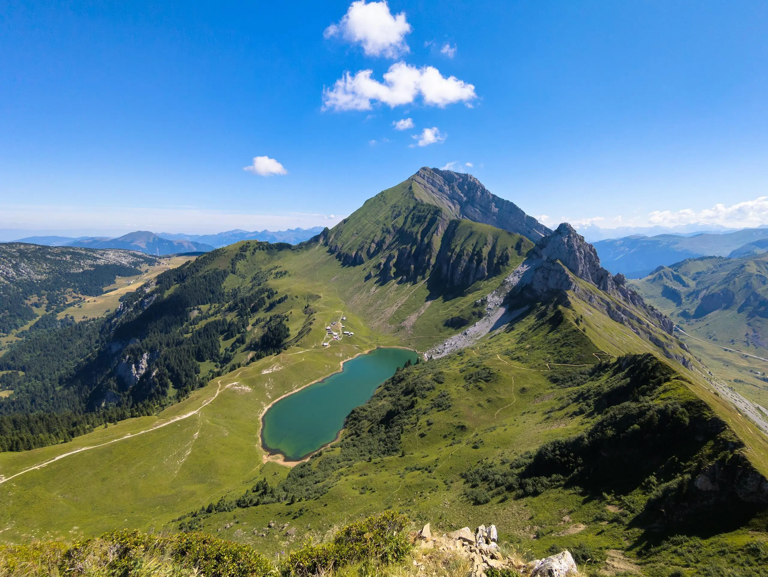
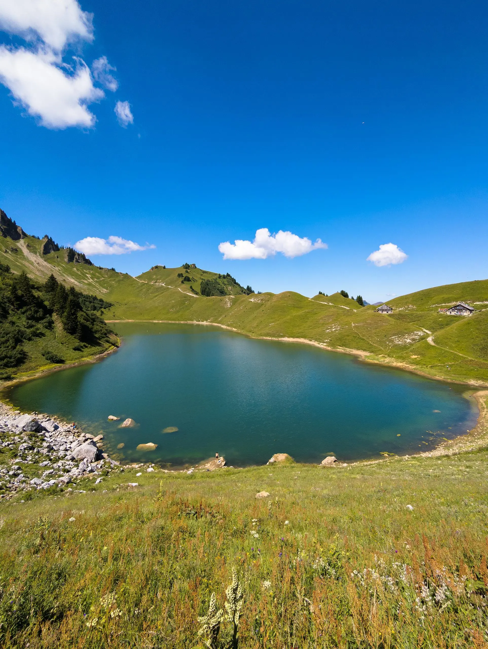
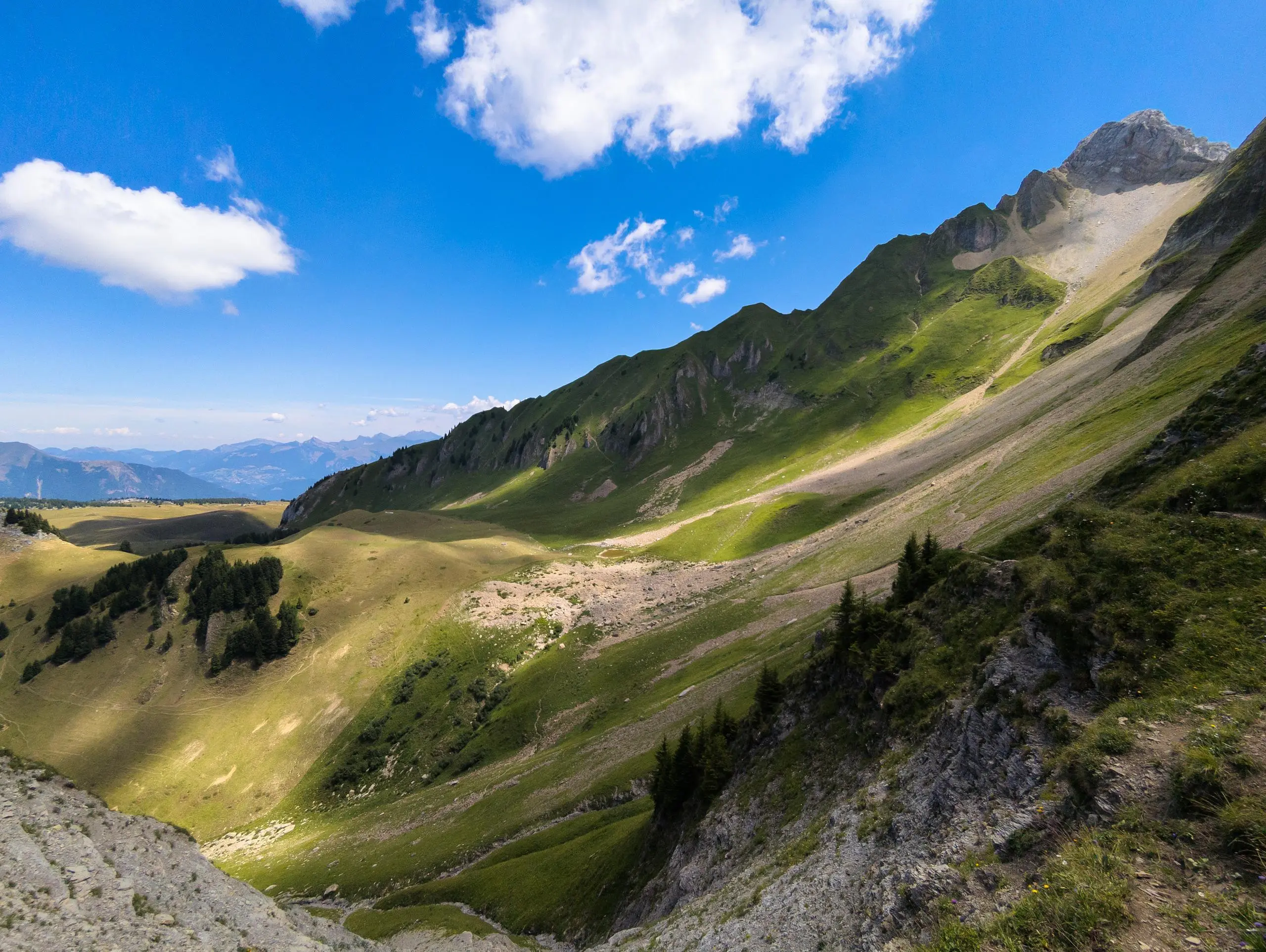
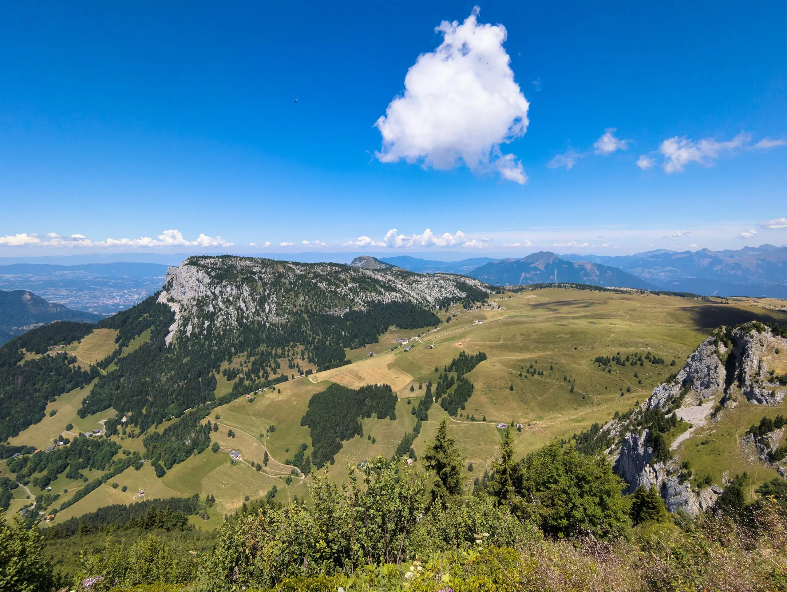
From the "Paradis" parking lot, follow the signs to the Col de la Forclaz. Once at the pass, there are several possible routes: either to the lake, or to the right, up to the Col de Buclon. From here, you can climb to the summit of the Aiguille Verte. The climb is not particularly difficult, just a little steep. Return along the same path, then turn right at the col to reach Lac de Lessy. You can then go on to the Col de Sosay for a lovely view of the Solaison plateau. To return, take the same path, passing the lake and returning to the parking lot.

(Description automatically translated)

Route profile

3927ft
Elevation gain
3911ft
Elevation loss
4429ft
Min altitude
6696ft
Max altitude

How to get there

Trailhead: 2345 Voie Communale No18 De Paradis, 74130 Glières-Val-de-Borne, France

GPS coordinates of the trailhead: 45.99332, 6.4153 / 45°59'35'' N, 6°24'55'' E

Caution: May Cross Private Property

This route may pass through or near private property. Always respect posted signs, obtain permission where required, and follow local trespassing laws. MapPlanner does not guarantee public access along any route.

Safety Notice

Trail and road conditions may change without notice due to weather, construction, or other factors. Always verify current conditions before heading out. You are responsible for your own safety — follow local signage, obey traffic laws, and use your best judgment on the trail.