MapPlanner
7.359mi
Distance
3h15m
Duration
+2641ft
Elevation gain
-2638ft
Elevation loss
Moderate
Level

Mont Grelle

Route details

2.26mph
Speed
1520 kcal
Calories burned
13.6%
Avg grade
Loop trail
Route type
1969ft
Min altitude
4350ft
Max altitude
Steep climb

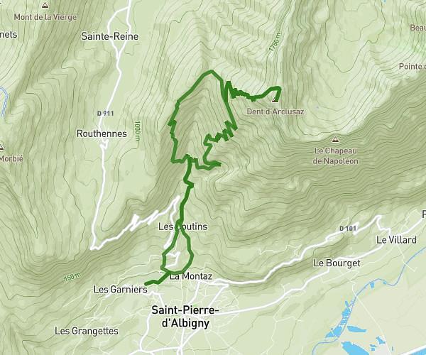
This hiking trail covers 7.359mi starting from Attignat-Oncin, Savoie. The hike is a loop trail and returns to the trailhead. This hike is rated as moderate, plan for about 3h15m to complete it. The route has an elevation gain of 2641ft and an elevation loss of 2638ft.

Description of the route by the creator

Mont Grelle on the Lake Aiguebelette side

(Description automatically translated)

Route profile

2641ft
Elevation gain
2638ft
Elevation loss
1969ft
Min altitude
4350ft
Max altitude

How to get there

Trailhead: 21 Route De La Fauchère, 73610 Attignat-Oncin, France

GPS coordinates of the trailhead: 45.50643, 5.77749 / 45°30'23'' N, 5°46'38'' E

Caution: May Cross Private Property

This route may pass through or near private property. Always respect posted signs, obtain permission where required, and follow local trespassing laws. MapPlanner does not guarantee public access along any route.

Safety Notice

Trail and road conditions may change without notice due to weather, construction, or other factors. Always verify current conditions before heading out. You are responsible for your own safety — follow local signage, obey traffic laws, and use your best judgment on the trail.