2 km
4.33km
Distance
2h10m
Duration
2.0km/h
Speed
184m
Elevation +
184m
Elevation -
550m
Min altitude
646m
Max altitude
Easy
Level

Réserve naturelle du Roc de Chère

View of Mont Baron from Roc de Chère
View of Doussard from the Roc de Chère lookout
View of the Bauges from the Roc de Chère belvedere

Route details

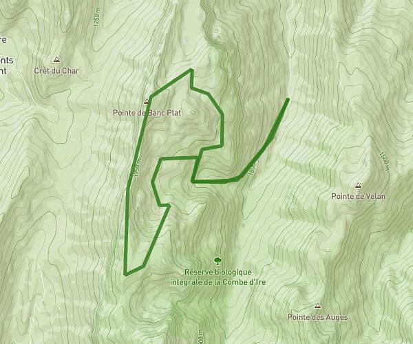
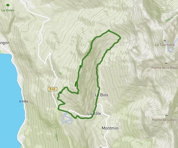
Explore this hiking route of 4.33km starting from Talloires-Montmin, Haute-Savoie. The hike is a loop and returns to the starting point. This hike is rated as easy, plan for about 2h10m to complete it. The route has a positive elevation gain of 184m and a negative elevation loss of 184m.

Description of the route by the creator

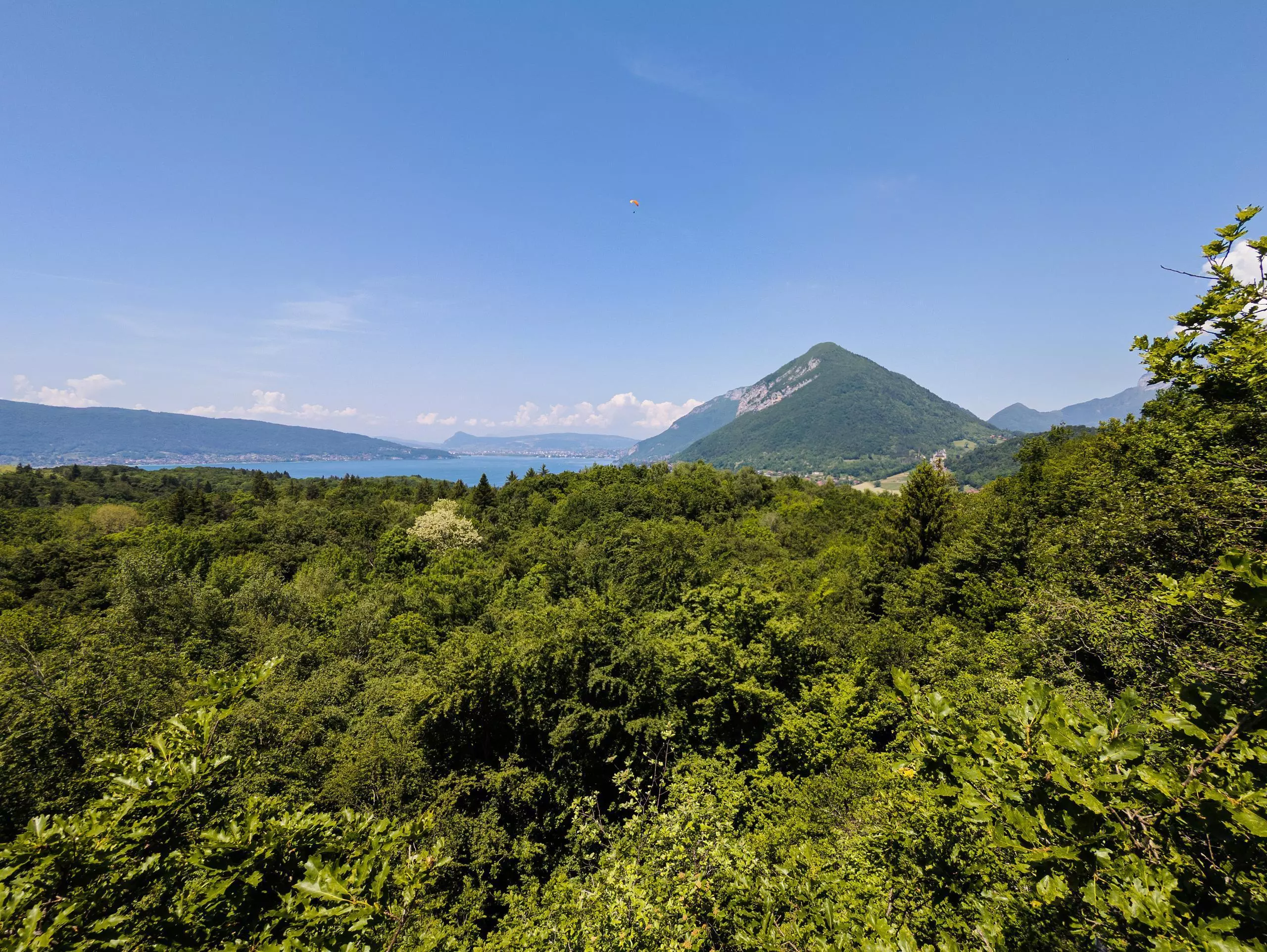
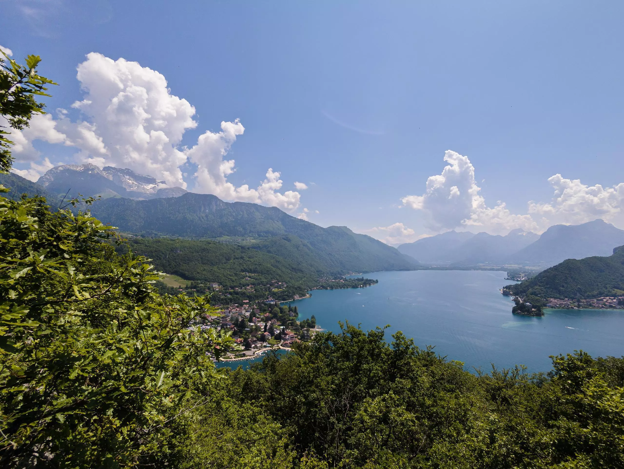
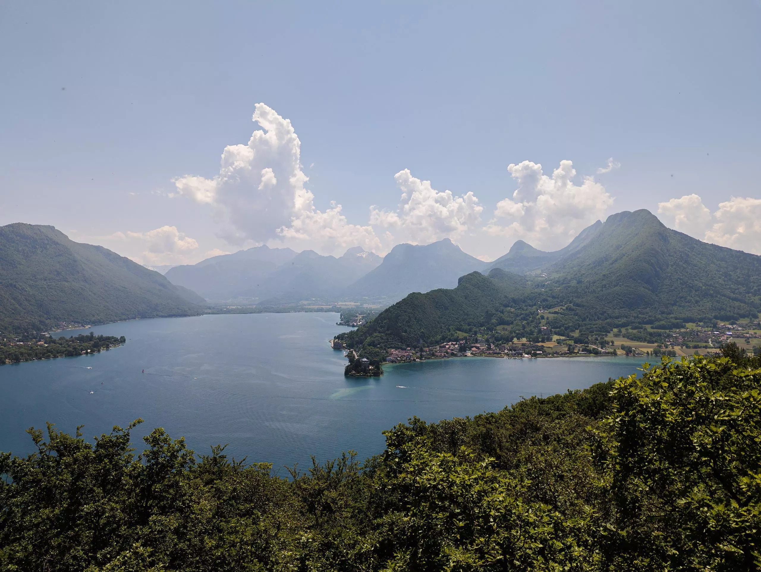
Easy walk with beautiful views over Lake Annecy. Just follow the signs, as the path is well indicated.

(Description automatically translated)
Annecy

Route profile

184m
Elevation +
184m
Elevation -
550m
Min altitude
646m
Max altitude

How to get there

Route starting point: Route Du Golf, 74290 Talloires-Montmin

GPS coordinates of the starting point: 45.85077, 6.20345 / 45°51'2'' N, 6°12'12'' E

Calculate the time to reach the starting point from your location or an address